Sunday 27 August 2017

868MHz LoRa HAB Tracking Success

Most HAB (High Altitude Balloon) tracking in the UK involves the use of 434MHz ISM devices due to the ready availability of suitable antenna and receiver equipment due to it sharing the 70cm amateur radio bands.

868MHz ISM devices are available but are not as widely used. Back in December I posted about trying to track a flight by HAB Enthusiast Dave Akerman who is experimenting using LoRa devices on this band. I had limited success receiving that flight and another ones so when I saw that Dave was planning another flight today using 868MHz LoRa I had a rethink on how to approach tracking it.

The antenna I used was a collinear one built from cheap satellite coax, similar to that I built for ADB-S however rather than having a long coax run to the LoRa gateway I opted to put the Raspberry Pi up on the pole at the base of the antenna to limit any loss.

The antenna can be seen connected to the Raspberry Pi and LoRa add on board, the Pi has a WiFi dongle.


The antenna was inserted into a piece of conduit to keep it upright and it and the Pi were strapped to a 5m painters pole (using a plastic lid as an insulator)


A USB power pack was also strapped to the pole to keep the Pi powered, hopefully you can see it in the photo below.


The pole was put up and was about the same height as my normal dual band collinear


Well it all worked extremely well, and got a lot of decodes as can be seen by the pie-chart generated by the habitat.habhub.org system, the third best receiver only bettered by Dave himself (M0RPI) and a station nearer to the flight path.

You can see my geographical position relative to the flight below (I am the station NNE with the green line, about 160km away) and received a lot of telemetry strings even when the height of the balloon meant I was outside the 5 degree above the horizon circle (shown in green).


The Pi was connected to my network via WiFi and controlled by a Putty console on my shack PC


It was a useful experiment and I am thinking of installing a dedicated mast mounted LoRa receiver with 868 and 434MHz antennas (and possibly pre-amps and filters) following this result.

Monday 14 August 2017

Shortwave Radiogram

In March 2013 The Voice of America (VOA) started an experiment called the VOA Radiogram which transmitted digital text and images using the powerful 50 year old analog shortwave broadcast transmitter at the Edward R. Murrow Transmitting Station near Greenville, North Carolina.

The idea was anyone could receive the radiogram on any shortwave radio, even an inexpensive portable one with no SSB capability. By feeding the audio from the radio to a computer, either by a audio lead or even using the a microphone the listener could decode the text and images using simple software.

I had seen mention and reports on social media of people receiving them but somehow never got around to trying it myself.

VOA ended the experiment back in June this year a week before the retirement of the program producer Dr. Kim Andrew Elliott.  An offer to continue the broadcasts on a contract basis was declined, so a follow-on show called Shortwave Radiogram began transmission from the WRMI Radio Miami International transmitting site in Okeechobee, Florida and Space Line in Bulgaria.

The Shortwave Radiogram transmission schedule is (at the time of writing and all times UTC)
Saturday 1600-1630 9400 kHz
Sunday 0600-0630 7730 kHz
Sunday 2030-2100 11580 kHz
Sunday 2330-2400 11580 kHz
All via WRMI except for 9400 kHz, which is via Space Line in Bulgaria.

I spotted a tweet a few weeks back (can't remember who from) mentioning the @SWRadiogram so my interest was piqued, I wasn't around for this weekends Saturday transmission in Europe but had a go on Sunday for the one from America. I wasn't expecting great things due to the levels of noise and poor conditions of late.

I have the decoding program FLdigi already installed on my computer for other datamodes and for information on how to decode the radiograms (sent using MFSK32) visit this page

On the 0600UTC transmission I managed just one poor image


 but during the Sunday 2030UTC transmission I got four decent images, the fifth was lost to QRM


I also made two short videos (on hand held mobile phone so a bit shaky) which show the incoming text and images.

Monday 24 July 2017

ARISS 20th Anniversary SSTV

This weekend has seen another SSTV event from the International Space Station, this time in commemoration of the 20th Anniversary of ARISS (Amateur Radio on the International Space Station)

The 20 year history of ARISS was displayed through a collection of 12 images highlighting the accomplishments of the project over the last two decades.

As the ISS has orbited the world it has been transmitting the SSTV signals using FM on the usual downlink of 145.800 MHz, here at my QTH in the UK the passes have occurred late at night into the early morning, averaging 3 - 4 reasonable passes each day.

The signal has been very strong and so some excellent low noise images have been received by many people using just modest equipment. While not the greatest technical achievement in the world it nonetheless generates much needed interest in ARISS and amateur space communication.

My own system consisted of the Yaesu FT-857D and MMSSTV running on the shack PC and was left on automatic receive (I was tucked up in bed) and managed to get decent copies of all the images.

Image 8 reminded me of the fun I had back in 2011-2012 of receiving the ARRISAT-1 and was one of the key things that convinced me to finally get off my backside and actually get licensed, even if it took me another 12 months and to this day haven't really cracked satellites myself! My previous blog posts on that can be found at http://nerdsville.blogspot.co.uk/search/label/arissat-1

Here are the best of my images, for a full description of what each one depicts visit http://ariss-sstv.blogspot.co.uk/2017/07/anniversary-image-descriptions.html


Monday 24 April 2017

First SOTA activation - Normanby Top G/TW-005

We ventured out to the Lincolnshire Wolds again on Saturday and spent most of the morning taking in a fabulous little 5 mile circular walk from the village of Wold Newton with the wife finding over twenty geocaches along the way.


After last weekends disappointment I had purchased a new Baofeng UV-82L dual band for the princely sum of £27 from eBay to replace the suspect UV-5R. It certainly seems more sensitive when receiving and the transmit audio is loud and clear.

With the 'flower-pot' antenna in the rucksack I spent the walk monitoring the local repeaters (and could hear the regular idents) as well as the calling channels. I was putting out the odd call (with little success) when we stopped to allow the wife to search for the geocaches.

One man and his dogs
However I wasn't disheartened as the plan was to spend the afternoon on Normanby Top, the highest point on the Lincolnshire Wolds trying to activate the summit for SOTA.

I had been spurned on to have a go at an activation after watching a video of  Michael Sansom's (G0POT) presentation on the SOTA scheme for the Chertsey Radio Club. The video is available online here and Michael has written an excellent companion introduction to SOTA on his website http://peanutpower.co.uk/sota

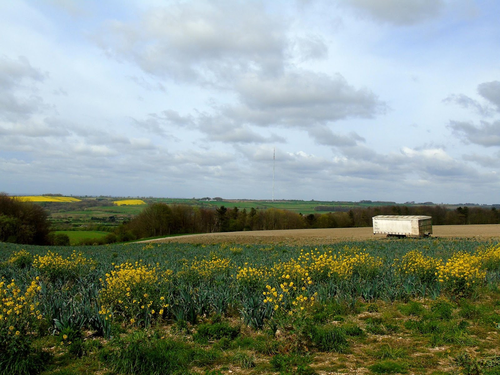
View across to radar station on Normanby Top
After finishing the walk we drove the short distance stopping to collect more geocaches along the way and as we neared Normanby Top we stumbled across Thoresway Motoparc where they were busy practising their motorbike scrambling skills and I spent a while taking some action photographs from the side of the road.

Saw some spectacular jumping skills
But I digress, Normanby Top, as I've said is the highest point on the Lincolnshire Wolds and the actual summit has an Ordnance Survey triangulation pillar as indicated on the map but it on private land. The SOTA rules allow someone to activate a summit by being within 25m vertically of the high point, this means the activation area for Normanby Top is potentially huge as it is more of a plateau than a steeply defined hill.

Section of the 1:25000 Ordnance Survey Map

To the South of the summit is a road with an air-traffic control radar station. We parked up near this impressive structure to have some very late lunch (time had flown by)

Radar Station on Normanby Top
I could have activated from this road as others have done but I decided to use the bridleway to the North which leads off the Viking Way long distance footpath. The wife dropped me off at Acre House Farm and she went off to hunt for yet more geocaches and I set off down the track to find a suitable place to set up. I was a little hampered by the proximity of a power line which followed the bridleway but as luck would have it just as I had finished setting up at my chosen spot the landowner came down the farm track in his Land Rover.

I had a friendly chat with him and he was fully aware of what I was doing and had no issues having met other activators in the past. He also gave me permission to walk across his land up to the trig-point if I wanted to. As I've mentioned it isn't on a public right of way but said he is more than happy for people to go to the trig-point providing they ask at the farm before hand and take home all their rubbish, unfortunately he has some recent problems with inconsiderate litterers.

I decided to decamped and following his instructions to a gap in the fence and set off to the trig-point which was a little bit further away and a little steeper than I thought, but it didn't help I was carrying a half made up antenna, poles and a bag full of kit and my not inconsiderate bulk! Anyway I got there but due to us running already behind schedule and my change of location it was getting late in the day and was nearly 5pm.

Trig-point and radar station behind

I had taken my Yaesu FT-857D, two 7Ahr SLA batteries, fibreglass pole, antennas for 20m/40m HF, 2m SSB and 2m/70cm FM. Yes I'd travelled light! Having some lovely clear views all around I decided to try some 2m 'line of sight' contacts.

I put up the Sandpiper Delta Beam for SSB (horizontal) and my 'flower-pot' dual band for FM (vertical) on a fishing pole. The wind had started to pick up and I'd not got any proper bungee cords (doh!) so I lashed it up using guy ropes around the pillar.

It was straighter than this before I went to take photo
The radio was perched on top of the pillar and I put some calls on 2m SSB with no luck and switched to FM with more success. I was using between 5-10W and got nothing exceptional distance wise but racked up 8 very nice clear QSOs to claim an activation. The wife texted me to say she had returned from her searching and was parked up patiently at the farm awaiting my return, not hurrying me by any means. It was now nearly 6pm and the wind was getting up and the temperature was starting to drop. It had been a long day for us and the dogs so I decided to packed up and went back down the hill to the bridleway admiring the view across to the Humber and the Humber crossing.

View North (Humber to the top left)

I really enjoyed myself but wished I'd allowed myself more time, this was in part because it was a late decision in the week to tack the 'summit' on the end of a day out walking and changing my mind to actually go to the summit given the chance but it was nice to do that for my first SOTA but I really need to get the hang of travelling light.

Back down and met by the wife who wanted her shopping bag back
After my last post (which is also syndicated to AmateurRadio.com) I had some questions about Geocaching - Dave, WD8CIV left this useful comment which I shall repeat as summed it succinctly - thanks Dave.

"Geocaching is like a high tech Easter egg hunt. People hide caches – waterproof containers containing a logbook and maybe some little trinkets – and then post the GPS coordinates to a Web site like geocaching.com. Others will search the site for caches in an area of interest, then use their own GPS (and intuition and woodcraft skills) to try to find them. Anyone who finds a cache signs the logbook, may take one of the trinkets and/or leave a new one, then goes back to the Web site and reports that they found that cache. There’s quite a community of geocachers, and it’s been going on for over a decade."

Tuesday 18 April 2017

Out portable on the Lincolnshire Wolds

This Easter weekend we decided to go out with the dogs and combine three hobbies, walking, geocaching and amateur radio whilst taking the opportunity to visit some radio related relics of World War II and the Cold War on the Lincolnshire Wolds.

Following a recent presentation at the South Kesteven ARS by David Gordon G6ENN where he talked about his successful portable operating I was encouraged to constructed a simple dual band 'flower pot' antenna (design from VK2ZOI) using some RG58 coax and 25mm conduit.

Completed 2m/70cm Flower Pot

My previous attempts at portable operating have largely involved HF and slightly heavy equipment (my Yaesu FT-857D and Sealed Lead Acid batteries) but I decided this time to try VHF/UHF as we were going to one of the highest spots in the area. This allowed me to travel light just taking along a Baofeng UV-5R and the antenna sticking out of the rucksack.
Just setting off with Boris & Eddie

Parking up in Donington on Bain we had a short 4 mile circular walk planned allowing the wife to collect a dozen geocaches along the way with a short detour at the top to visit RAF Stenigot. The walk climbs to the top of a hill, but it isn't a long ascent by any means or overly strenuous. The view back included the impressive Belmont Transmission Tower (just visible over my shoulder in the picture above) which before it was shortened in 2010 was reputably the tallest structure of its type in the world.

Belmont Transmission Tower

The Lincolnshire Wolds is the highest area on the East of England between Yorkshire and Kent and so there are many structures that take advantage of the elevation. In addition to Belmont we could see the Radar station at Wolds Top/Normanby Hill and Lincoln Cathedral in the distance, but we were interested in what was in front of us the remains of RAF Stenigot.

The tower at RAF Steingot, clearly visible as we climbed


View back
RAF Stenigot was part of the Chain Home radar network during World War II, this early system used large antenna arrays suspended from large towers, one of which is now preserved as a Grade II listed structure which is still used by RAF Aerial Erector School for selection tests for possible recruits.

After the Second World War, the site was retained and in 1959 it was upgraded to a communications relay site as part of the NATO ACE High system, which involved adding four tropospheric scatter dishes. The site was decommissioned in the late 1980s and was mostly demolished by 1996 but the toppled dishes remain.

View of RAF Stenigot
While on private land with no public right of way it is a simple matter to follow the field edge to get quite close, the actual site has been secured to prevent vandalism and is now home to a herd of bulls to deter trespassers!

The dishes as seen from the footpath
At the gate (locked) to the site

View looking towards the radar tower

Yours truly
We stopped in the shadow of the dishes for a drink and some refreshment and I got out the radio and attempted to make some contacts, but sadly it seemed like everyone was in still in bed. I could open quite a few nearby repeaters and put out calls but again nothing heard, hopefully ET had better luck!

ET Phone Home!
Checking the equipment when I got home it seems the Baofeng radio has developed quiet TX audio, so it is likely people couldn't hear me. I haven't used these cheap radios much and know they are prone to issues but thought mine was okay. Oh well, at least I looked the part and got a few odd glances from the few walkers and locals we saw. What I didn't realise at the time is the hill is also the site of GB3LC but I did spot some amateur radio antennas nearby.

CQ CQ M0NRD/P
The Chain Home Radar tower

The "Heavy Mob" Security Patrol
It really was a great morning walk in a part of the country which is on our doorstep but haven't really visited before. Getting up close to the dishes and the Radar mast was fascinating.

What's more you aren't far from the Lincolnshire Coast, so after our walk we went to Mablethorpe for the afternoon and fish and chips which were well received.

Eddie enjoying his fish and chips
Might look at activating Wolds Top in the near future as it is also a SOTA summit!